GIS and BIM Integration in Building and Infrastructure - TXG
GIS and BIM Integration in Building and Infrastructure
Unlocking the Power of Spatial Intelligence and Building Information Modeling
Introduction
The integration of Geographic Information Systems (GIS) and Building Information Modeling (BIM) is transforming the way infrastructure and urban planning projects are designed, executed, and maintained. The integration of Geographic Information Systems (GIS) and Building Information Modeling (BIM) is revolutionizing the digital construction industry by enabling a data-driven approach to infrastructure planning, urban development, and facility management. While GIS provides spatial context, BIM delivers detailed 3D models and data-rich insights into buildings and infrastructure. By combining these two technologies, professionals can achieve a holistic, data-driven approach to construction, smart cities, and infrastructure development.
What is GIS?
Geographic Information Systems (GIS) is a technology that collects, analyzes, and visualizes spatial data to represent real-world locations, topography, and environmental factors. It helps in:
Mapping and Visualization – Provide geospatial context for decision-making.
Infrastructure Planning – Analyzes land use, transportation, and environmental impact.
Disaster Management – Predicts risks and improves emergency response planning.
What is BIM?
Building Information Modeling (BIM) is a digital representation of a building’s physical and functional characteristics. It is a model-based process that provides architects, engineers, and construction professionals with intelligent insights to design, construct, and manage buildings and infrastructure more efficiently.
Unlike traditional 2D drafting methods, BIM enables 3D modeling with integrated data, improving collaboration, reducing errors, and enhancing project efficiency across its lifecycle.
Key Features of BIM
3D Modeling and Visualization
BIM software allows users to create highly detailed 3D models of buildings and infrastructure.
These models include geometric, spatial, and material properties for accurate visualization.
Data-Rich Digital Models
Unlike simple CAD drawings, BIM models store real-time information about the structure, such as material specifications, costs, and operational details.
Collaborative Workflow
BIM provides a centralized platform where architects, engineers, and contractors can work together seamlessly.
Cloud-based BIM tools enable real-time updates and version tracking for efficient project coordination.
Clash Detection and Conflict Resolution
BIM software automatically detects design conflicts (e.g., a plumbing line clashing with an electrical conduit) before construction begins, reducing costly rework.
Lifecycle Management
BIM supports the entire building lifecycle, from planning and design to construction, operation, and demolition.
Facility managers can use BIM models for predictive maintenance, asset tracking, and renovations.
Why Integrate GIS with BIM?
The integration of BIM with GIS GIS with BIM enhances decision-making by combining detailed building information with geospatial intelligence. Key benefits include:
- Infrastructure Planning & Development
GIS provides spatial analysis for selecting the best locations for buildings and infrastructure.
BIM adds design precision, ensuring structures align with environmental conditions.
- Urban Planning & Smart Cities
GIS helps analyze land use, utilities, and traffic patterns for optimized city development.
BIM integrates architectural BIM services to create intelligent digital city models.
- Environmental Impact & Sustainability
GIS identifies flood zones, seismic activity, and climate risks for informed decision-making.
BIM supports energy-efficient building design and sustainable construction practices.
- Construction & Asset Management
GIS aids in site analysis, logistics, and material transportation.
BIM enhances facility management through digital twin integration for real-time asset monitoring.
How to Integrate GIS with BIM?
Integrating GIS and BIM requires a structured approach to ensure seamless data exchange and collaboration. Below are the key steps:
- Define Project Goals
Before integration, define the objectives. Is it for urban planning, asset management, or environmental analysis? Clear goals help in selecting the right tools and datasets.
- Select Compatible GIS and BIM Software
Popular GIS software includes ArcGIS, QGIS, and MapInfo, while common BIM platforms are Autodesk Revit, Bentley MicroStation, and Tekla Structures. The selected platforms must support interoperability.
- Ensure Data Compatibility
BIM uses Industry Foundation Classes (IFC) and Revit (.rvt) files, while GIS mainly uses Shapefiles (.shp) and GeoJSON. Use conversion tools like FME, InfraWorks, or ArcGIS BIM Integration to bridge the gap between formats.
- Use Cloud-Based Collaboration
Cloud platforms like Autodesk BIM 360 and ESRI ArcGIS Online allow seamless data exchange and real-time collaboration between teams.
- Implement Digital Twin Technology
Integrating Digital Twins with GIS and BIM helps create live models of infrastructure projects, improving maintenance, monitoring, and predictive analysis.
Key Technologies Powering GIS & BIM Integration
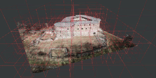
- 3D GIS Mapping
3D GIS Mapping allows for realistic, interactive visualization of terrain and infrastructure.
It helps in planning urban layouts, analyzing elevation data, and detecting topographical challenges before construction begins.
Software like ArcGIS CityEngine and Autodesk InfraWorks supports 3D spatial modeling for better design coordination.
- Cloud-Based BIM & GIS Integration
Cloud platforms like ESRI ArcGIS Online and Autodesk BIM 360 enable real-time collaboration.
These tools store and synchronize data across multiple locations, ensuring architects, engineers, and urban planners work with the latest information.
They also provide version control to track changes and maintain project transparency.
- AI & IoT Sensors
Artificial Intelligence (AI) enhances spatial analytics, identifying patterns in urban planning and infrastructure maintenance.
IoT sensors integrated with GIS and BIM help monitor building health, detect structural issues, and automate facility management.
AI-driven predictive maintenance reduces operational costs by forecasting equipment failures before they occur.
- Digital Twin Technology
Digital Twin technology creates real-time, dynamic models of physical infrastructure.
These live simulations provide real-time monitoring, predictive analytics, and scenario testing for construction and facility management.
By linking GIS spatial data with BIM models, Digital Twins help optimize energy consumption, detect wear and tear, and automate smart building operations.
Challenges of GIS and BIM Integration
Despite its advantages, GIS-BIM integration faces key challenges:
Data Compatibility – Merging different data formats from GIS and BIM requires interoperability solutions.
High Implementation Costs – Initial investment in software, training, and infrastructure is necessary.
Technical Expertise – Requires skilled professionals proficient in GIS-BIM integration methodologies.
Integrating GIS and BIM is revolutionizing how we approach infrastructure development, urban planning, and facility management. By combining GIS’s spatial intelligence with BIM’s detailed building data, professionals can create smarter, more sustainable, and more efficient built environments. Integrating GIS and BIM revolutionizes infrastructure development, urban planning, and facility management, driving more innovative, sustainable, and highly efficient built environments. By combining GIS’s spatial intelligence with BIM’s data-rich 3D modeling, professionals can optimize resource utilization, enhance decision-making, and improve project coordination. This fusion enhances decision-making, improves project coordination, and drives cost savings throughout the infrastructure lifecycle. As technology evolves, the synergy between GIS and BIM will play a pivotal role in shaping the future of smart cities and digital construction. This fusion not only lowers construction costs through early clash detection and predictive analytics but also improves long-term asset management with AI-driven Digital Twins and IoT-based real-time monitoring. As smart cities and digital construction evolve, the collaboration between GIS, BIM, and AI analytics will be key in shaping the future of smart cities and digital construction.
© 2023 TXG - Technical Experts Group. All rights are reserved.